
7 kun Kilimanjaro Umbwe yo'nalishi
Bosh sahifa » 7 kun Kilimanjaro Umbwe yo'nalishi
7 kun, 6 kecha
So'rov bo'yicha narx
Turga umumiy nuqtai
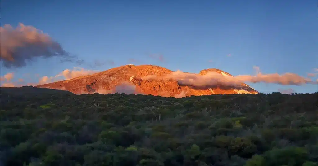
The Umbwe yo'nalishi is short, steep, and straightforward. It is considered to be the most difficult route up Mount Kilimanjaro. Because of the rapid ascent, Umbwe does not provide the necessary stages for altitude acclimatization. Although traffic on this route is low, so are the chances of success. The route is offered for at least six days, but seven days is recommended. The Umbwe route should be attempted only by experienced hikers who are confident in their ability to acclimate. Overall, the Umbwe route is not recommended, and we discourage our clients from using it.
Ekskursiya xulosasi
kun 1
UMBWE GATE (1,800M/5,905FT) TO CAVE BIVOUAC LAGERI (2,850M/9,350ft)
Turar joy: G'or Bivouac lageri
Ovqatlanish rejasi: Nonushta, tushlik, kechki ovqat
kun 2
CAVE BIVOUAC (2,850M/9,350ft) BARRANCO LAGARIGA (3,950M/12,960ft)
Turar joy: Barranco lageri
Ovqatlanish rejasi: Nonushta, tushlik, kechki ovqat
kun 3
BARRANCO LAGERI (3,900 M/12,800 ft)
Turar joy: Barranco lageri
Ovqatlanish rejasi: Nonushta, tushlik, kechki ovqat
kun 4
BARRANKO LAGERI (3,950M/12,960FT) KARANGA vodiysiga (4,200M/13,780FT)
Turar joy: Xorombo kulbasi
Ovqatlanish : Nonushta, tushlik, kechki ovqat
kun 5
KARANGA vodiysidan (4,200M/13,780ft) BARAFU LAGERGA (4,600M/15,100ft)
Turar joy: Barafu lageri
Ovqatlanish : Nonushta, tushlik, kechki ovqat
kun 6
BARAFU LAGERI (4,600M/15,100FT) TO UHURU cho'qqisi (5,895M/19,340ft) TO MWEKA LAGERI (3,100M/10,170FT)
Turar joy: Mweka lageri
Ovqatlanish : Nonushta, tushlik, kechki ovqat
kun 7
MWEKA lageridan (3,100M/10,170ft) MWEKA darvozasiga (1,500M/4,920ft)
Biz bilan bron qiling
Kundan kunga
1-kun: UMBWE GATE (1,800M/5,905FT) TO CAVE BIVOUAC LAGERI (2,850M/9,350ft)
Elevation Gain: 1,050 meters (3,445 feet)
Hiking time: four to six hours.
Ovqatlanish: Nonushta, tushlik va kechki ovqat kiradi.
Leave Moshi/Arusha early for Umbwe Gate. Meet our porters, guides, and cooks who will accompany you on a six-day trek to Uhuru cho'qqisi, Africa’s highest peak. When you arrive, wait at the gate while we register your climb and the porters and guides make final preparations.
The first day’s destination is Cave Bivouac Camp, which is about 6 hours from the gate. The trail is steep and can be slippery in spots. Hike through the Kilimanjaro cloud forest’s most densely covered trees. The forest will thin later in the hike, revealing heathers, tall grasses, and wildflowers. Porters and cooks will go ahead and set up the camp in preparation for your arrival.
2-kun: CAVE BIVOUAC (2,850M/9,350ft) TO BARRANCO LAGARASI (3,950M/12,960ft)
Umumiy balandlikning o'sishi: 1,100 metr, 3,610 fut
Yurish vaqti: 5 dan 7 soatgacha
Ovqatlanish: Nonushta, tushlik va kechki ovqat
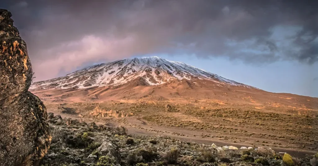
The first section of the trail continues along the ridge. After leaving the forest, continue through open moorlands to Barranco Camp. Barranco is widely regarded as the most scenic campsite on the Umbwe Trail, with giant senecios and lobelias surrounding it. Barranco has a later sunrise than the other camps because it is located in a valley.
3-kun: BARRANCO CAMP (3,900 M/12,800 ft)
Extra day for acclimatization. Adding this day will reduce your effort and accelerate your acclimatization.
Ovqatlanish: Nonushta, tushlik va kechki ovqat
4-kun: BARRANKO LAGARIDAN (3,950M/12,960FT) KARANGA vodiysiga (4,200M/13,780ft)
Balandligi: 250 metr, 820 fut
Masofa: 7 km
Yurish vaqti: 3 dan 5 soatgacha
Ovqatlanish: Nonushta, tushlik va kechki ovqat kiradi.
After breakfast, leave Barranco Camp and head to Karanga Valley. The day starts with a 1.5-hour scramble up Barranco Wall. This is the most difficult part of the day, and in some places you may need to use your hands to help you climb. After reaching the summit, hike through relatively flat terrain before making a short but steep descent into the lush Karanga River Valley.
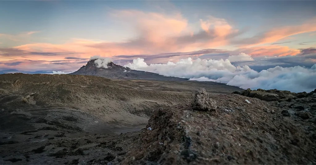
Wake up early with a hot cup of coffee or tea, and leave between 12:30 and 1 a.m. Temperatures range from just below freezing at midnight to between 10 degrees Fahrenheit (-12 degrees Celsius) and -10 degrees Fahrenheit (-23 degrees Celsius) just before dawn at Gillman’s Point, located at an elevation of 18,652 feet (5,685 meters) on the crater rim. The winding scree path of the endless switchbacks will carry you through the night, and at dawn, the spires of Mawenzi will be visible against the sun’s red glow beneath the clouds.
After approximately 6 hours of walking, you will reach the crater rim near the Ratzel glacier. When you reach Gillman’s Point, gather your strength for another 1.5-hour hike on a gentle slope around the crater rim to the highest point.
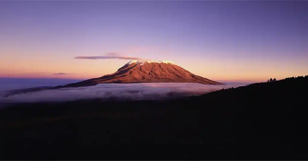
Uhuru Peak stands at 19,340 feet (5,895 metres). After a brief stay at the summit, descend the steep scree path to Kibo Hut for a rest before continuing down to Horombo Hut for the night.
Turar joy
Xorombo kulbasi | FB
5-KUN: KARANGA vodiysidan (4,200M/13,780FT) BARAFU LAGERIGA (4,600M/15,100ft)
Balandligi: 400 metr, 1,320 fut
Yurish vaqti: 3 dan 5 soatgacha
Ovqatlanish: Nonushta, tushlik va kechki ovqat
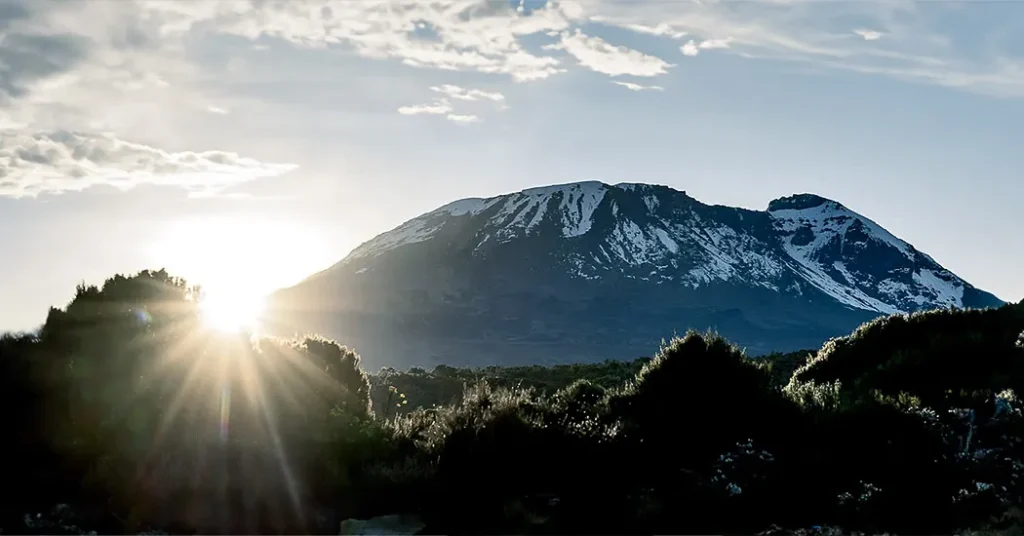
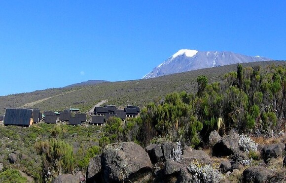
After breakfast, start hiking to Barafu Camp. View several of Kibo’s glaciers along the way to Barafu, as well as the junction that connects the Mweka descent route with the Machame trail. On day four, hike to the Heim, Kersten, and Decken Glaciers. Although the trail to Barafu passes through an alpine desert with little vegetation, Barafu Camp provides breathtaking views of Kibo and Mawenzi peaks. Try to sleep after dinner because you’ll be up before midnight for your summit hike.
6-kun: BARAFU LAGERIDAN (4,600M/15,100ft) UHURU cho‘qqisiga (5,895M/19,340ft) MWEKA LAGERiga (3,100M/10,170ft)
Balandligi: 1,295 metr, 4,240 fut
Balandlik yo'qolishi: 2,795 metr, 9,170 fut
Piyoda yurish vaqti: chetiga 6 soat, Uxuruga 1 soat, Barafuga 3-4 soat, Mvekaga 4 soat.
Ovqatlanish: Nonushta, tushlik va kechki ovqat
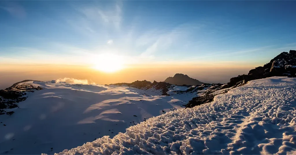
Around midnight, start the final ascent to Uhuru Peak. Hike for the next six hours under the light of your headlamp. The climb to the crater rim is the most difficult part of the entire journey. The trail is extremely steep until you reach the crater rim at Stella Point.
The hike from Stella Point to Uhuru Peak is a gradual climb that is not particularly difficult. The altitude, however, makes the hike lengthy and exhausting. The crater rim hike takes about an hour. When you arrive at Uhuru, take photos of your guide and group before heading down to Mweka Camp. On the way down from Uhuru, take in the views of the mountain, crater, clouds, and glaciers.
At Barafu Camp, eat breakfast and take a break. You still have three to five hours before reaching Mweka Camp.
7-KUN: MWEKA lageridan (3,100M/10,170ft) MWEKA darvozasiga (1,500M/4,920ft)
Balandlik yo'qolishi: 1,600 metr, 5,250 fut
Yurish vaqti: 4 soat
After breakfast, take a hike through the forest to Mweka Gate. The trail may become slippery after rain. Our vehicles will meet you at the lower station of Mweka Gate and take you back to Moshi/Arusha so you can continue with your schedule.
This marks the end of your seven-day Kilimanjaro Umbwe route.
narx
| PAX | 1 PAX | 2 PAX | 3 PAX | 4 PAX | 5 PAX | 6 PAX |
| narx | talab ustiga | talab ustiga | talab ustiga | talab ustiga | talab ustiga | talab ustiga |
kiritmalari
- Xavfsizlik uskunalari:
- Professional tog 'gidlar, barcha bosh yo'riqnomalar (har safar kamida 1 ta) hozirda NOLS USA tomonidan WFR (Wilderness First Responder) sifatida sertifikatlangan.
- Park to'lovlari
- Kamping to'lovlari
- Favqulodda qutqaruv to'lovlari
- Lager uskunalari va boshqa jihozlar:
- Tog'li taomlar
- Mehmonxonadan boshlang'ich nuqtasiga o'tish
- Oxirgi nuqtadan mehmonxonaga o'tish
Istisnolar
- Mehmonxonaga kelish va oxirgi kun
- Tog' yo'riqchisi uchun maslahatlar, har bir guruh uchun kuniga 15-20 tavsiya etiladi
- Porterlar har bir yukchi uchun kuniga 5-10$
- Shaxsiy xarajatlar
- Shaxsiy narsalar
- Shaxsiy sug'urta / sayohat sug'urtasi
- Shaxsiy dori-darmonlar / birinchi yordam to'plami
- Shaxsiy trekking jihozlari
- Qopko'rpa
Tez-tez beriladigan savollar (FAQ)
Yo'lboshchilar va yuk tashuvchilar kiritilganmi?
Ha. Barcha treklar quyidagilarni o'z ichiga oladi tajribali gidlar, yuk tashuvchilar va oshpazlarxavfsizlikni ta'minlash, jihozlarni olib yurish va ovqat tayyorlash.
Marshrutni moslashtirish mumkinmi?
Ha. Sayohat bo'lishi mumkin qo'shimcha akklimatizatsiya uchun kengaytirilgan yoki boshqa yo'nalishlar bilan birlashtirilgan qulaylik va muvaffaqiyat darajasini oshirish uchun.
Nima uchun 7 kunlik sayohat uchun Umbwe yo'nalishini tanlash kerak?
7 kunlik sayohat dasturi quyidagilarni taklif qiladi: qiyinchilik va iqlimga moslashish o'rtasidagi yaxshiroq muvozanat, hali ham taqdim etayotganda tinch va kamroq gavjum trekking tajribasi mashhur yo'nalishlar bilan taqqoslaganda.
Qanday turdagi turar joy taqdim etiladi?
Umbwe a lager yo'nalishi, har bir lager joyida chodirlar bilan ta'minlangan. Sayohatchilarni qo'llab-quvvatlaydi professional gidlar, yuk tashuvchilar va oshpazlar.
Qanday manzaralarni boshdan kechiraman?
Siz o'tib ketasiz zich yomg'ir o'rmonlari, tik tizmalar, botqoqliklar, alp cho'llari va cho'qqi zonalari, dramatik manzaralar va balandlikning tez o'zgarishidan zavqlanmoqda.
Umbweda 7 kunlik sayohat uchun nimani olib ketishim kerak?
Pack qatlamli kiyimlar, issiq kiyimlar, trekking etiklari, qo'lqoplar, shlyapa, quyoshdan himoya kremi, trekking tayoqchalari, faralar va kunduzgi ryukzakSharoitlar balandlikka qarab juda katta farq qiladi.