MOUNT HANANG
Home » MOUNT HANANG
The nature reserve is situated in Hanang District in the Manyara region, between Latitude 040 25.00′ to 040 29.00′ South of the Equator and Longitude 350 21.64′ to 350 27.00′ East of Greenwich. It is about 4 kilometers North of Katesh Township, the administrative center of Hanang District. Access to the reserve is through the southern side of Katesh township and the eastern side of Gitting village, which is about 240 km from Arusha town. The reserve area is 5,871 hectares, while the border length is 35.676 km.
The mountain is the third highest mountain in Tanzania after Kilimanjaro and Meru mountains, with an elevation of 3,676 m above sea level. The reserve has steep slopes with declining vegetation as you go up. On the western side, rocks on steep slopes occupy most of the area. The forest is continuously intercepted by ridges and valleys on the Western side, and the forest is found in valleys, while on the South and Eastern sides, ridges and valleys are covered by forest. The MHNFR is the major water source in Hanang District, with important rivers and streams. Soils are Dark to grey-brown and Reddish brown to orange-red. The reserve has oceanic rainfall with continental temperatures.
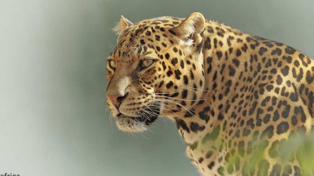
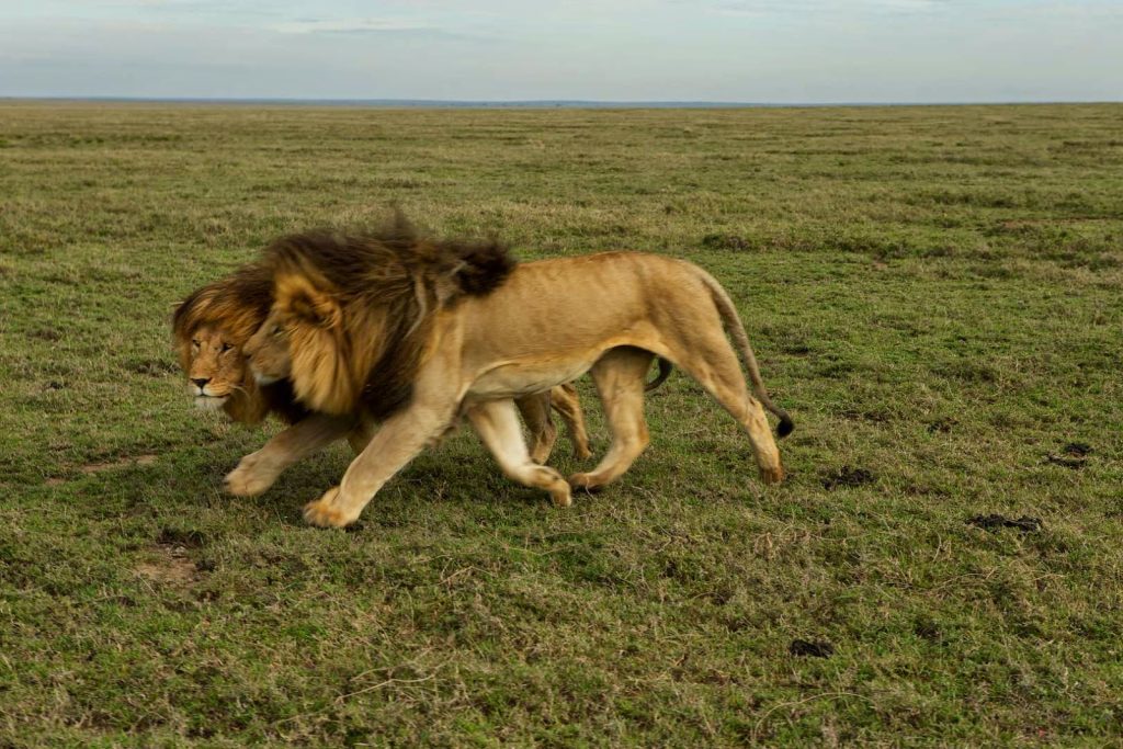
The reserve is comparatively rich in vegetation cover and species due to its wide altitudinal range and rainfall. The vegetation present is Montane forest on weather Southern and Northern slopes and Dry montane forest- on Western slopes between 1,980-2,780 m, Grassland and Bushland between 2,100-2,700 m. Thicket occurs at the edge of the reserve, and Moorland/Heath/upland occurs above 2,700 m. The dominant tree species include; Juniperus procera, Albizia gummifera, Fagaropsis angolensis, Catha edulis, Ficus thonningii, F. sur, Clodendrum capense, Ekebergia capensi, Nuxia congests, and Hagenia abysinica. The animals present are klipspringer, velvet monkeys, bush pigs, olive baboons, spotted hyenas, leopards, and various snakes, birds, and insects.
The reserve is used as an important worship area for the Barbaig and Iraqw tribes, the natives of the Hanang District. Big ficus trees of thorning species are normally used for this purpose. Three summits of Mt. Hanang, the highest having an altitude of 3,676 m a.s.l, form special sites where the local scenery of Hanang District can be viewed. Also, the Soda lakes of Balang’dalalu and Gendabi, the underground water of Lake Basotugang, Acacia woodland, and 28,000 ha of the wheat complex are clearly seen. Minjingu phosphate industry and Makuyuni trade center along the Arusha to Babati road are among the spectacular sites seen from the top of the summit. Also, Mount Hanang Forest Nature Reserve is nestled right close to the Great Rift Valley, which is a major big game viewing and photographic tourism destination
Clean hotels with reasonable prices and good services are available at Katesh township, where you can stay while you are in Hanang, like Summit Hotel, at 10 USD per day. Transport to the reserve is organized by local tour operators available in Arusha and Babati towns with their local tour guides[/vc_column_text][/vc_column][/vc_row][vc_row][vc_column][vc_column_text]Mount Hanang Nature Forest Reserve has an area of 5,871 at an altitude ranging from 1860 to 3418 meters above sea level. The forests are on an extinct volcanic mountain situated in Katesh town, Manyara Region.
Mount Hanang is the fourth-highest mountain in Tanzania after Kilimanjaro, Meru, and Olmalasin, with an elevation of 3,676 meters above sea level.
Hanang district is 73 km away from Babati town (region headquarters), where the beautiful Mount Hanang (3,448 m) is located.
Numerous different tribes live in the Hanang District. The Barabaig people are well known, and their traditional culture remains unchanged. They follow their procedures for marriage, burial of elderly men, religious rituals, and local taboos.
Their famous honey brew, called Gisuda, is well-known in the area. The Barabaig are a semi-nomadic tribe recognizable by their goatskin garments.
After a 5–6 hour walk through farmland, forest, scrub, and grasslands, you can reach the summit after another 5–6 hours of hiking. A two-day tour is advised.
The mountain is the habitat of leopards, klipspringers, velvet monkeys, olive baboons, dik-dik, and various bird species. The mountain features a beautiful catchment forest with a variety of tree species. Mount Hanang scenic view
Mount Hanang (3,423m) is the third-highest peak in Tanzania and arguably the hardest climb. While Mount Kilimanjaro and Mount Meru might be seen as the big challenges due to the multi-day trekking and altitude, there is no
single day on either of those treks with anywhere near the elevation gain of
Mount Hanang.
Rising from the town of Katesh, you will climb 1600 meters over 8.5 kilometers in about five hours. If the sun is out, expect a very tough hike, and if it is cold, you can expect to endure a freezing night at the campsite.
The incredible views from the summit over Katesh and Lake Balangida make it all worth the effort. The sunset and sunrise are truly incredible above the clouds.
MOUNT HANANG HIKE DETAILS
Hike Distance
The hike’s total distance is 17.5km out and back (return trip).
Hike Duration
This depends a lot on your speed and how much gear you are carrying. The ascent can be completed in about 5–6 hours, and the descent can be completed in about 3 hours. This depends on your ability to hike uphill with gear. According to Garmin, our total moving time was just six hours and twenty minutes (for the return trip/up and down), which doesn’t count any rest breaks or stops or sleeping at the summit.
Hike Difficulty
This trail is quite difficult due to the extreme incline. In 8.5 kilometers, you will ascend more than 1600 meters, which is done at a high elevation. The hike will reach 3,423m when you are at the summit, so expect to be short on breath.
The terrain is rocky and involves a lot of concentration as you step on boulders and rocks, making sure not to slip on the ascent.
And also the descent. You will need to be sure-footed in many sections but not any big drop-offs or moments of exposure. You are all set for this one if you can handle the incline, weather, and cold camping conditions.
Hike Incline
1,791 meters
Reachability
The area is accessible by road, either from Dar es Salaam via Dodoma and Manyara (about 800 km) or from Singida town (about 159 km). Visitors arriving at Kilimanjaro International Airport can proceed to the reserve, which is about 270 km away from Arusha City.
Mount Hanang is situated above the town of Katesh in the central-north region of Tanzania. From Arusha, the drive will take you about four hours by car or half a day by public bus.
Once in town, head to the Summit Hotel, which is the unofficial meeting point for guides and hikers. This is also where you will spend the night before and/or after your trek if you are spending the night.
Ecotourism Activities
Mount Hanang Nature Forest Reserve has multi-eco and cultural tourist activities such as;
-Traditional Dances
-Traditional Accessorizing
Visiting sacred sites
Local Brew Testing,
Hiking and trailing
-Mountain Climbing
-Game Viewing
-Bird Watching
-Forest Walks
-Photographing
Other tourist attractions found near Mount Hanang Nature Forest Reserve are Kondoa Rock Art Paintings, Essimingor Nature Forest Reserves, Tarangire National Park, and Lake Manyara National Park